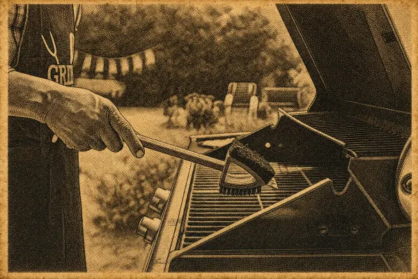

Heads up: some of the links in this post are affiliate links. That means if you click and purchase, we may get a commission. It’s how we keep this site running without cluttering it with ads.
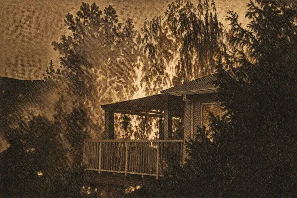
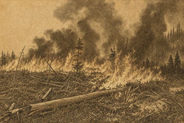
It’s a late-July Saturday in the Okanagan. The forecast hit 38°C by mid-afternoon, the lake looks strangely flat under a dull orange sky, and the air smells like a campfire you can’t find. Fine ash freckles the patio table. Then your phone buzzes: an Evacuation Alert. Outside, Highway 97 traffic slows to a crawl as people top up gas, hook up trailers, and text family in Kelowna, Vernon, and Penticton the same question—“Are you seeing this too?”
This guide is built for full-time BC households—rural acreages, townhomes, lake cabins, and city fringes—and for visitors caught on the wrong side of a road closure. We’ve rounded up the gear most BC families actually need (go-bag, HEPA purifier, N95s, hand-crank radio, power station, fire extinguisher spray, and a headlamp), then walked through assessing your risk, tightening up your home’s ignition zone, making a calm evacuation plan, and understanding coverage basics.
Recommended wildfire gear for BC households
Based on Amazon.ca availability, ratings, and how well each product fits BC wildfire scenarios, here are seven items worth having ready before peak season. None of these replace a solid plan, but they cover the most common gaps in Canadian households we’ve seen mentioned again and again in evacuation post-mortems.
| Product | Best for | Approx. price (CAD) |
|---|---|---|
| 72HRS Essential 2-Person Kit | Pre-packed go-bag | $190 |
| Levoit Core 300-P HEPA Purifier | Clean-air room | $150 |
| 3M Aura N95 Respirators (20-pack) | Smoke protection | $21 |
| RunningSnail Hand Crank Radio | Alerts when cell drops | $31 |
| Jackery Explorer 300 Power Station | Outage backup, EV/medical | $239 |
| First Alert EZ Fire Spray (2-pack) | Kitchen + garage knockdown | $77 |
| LHKNL Rechargeable Headlamp (2-pack) | Power-out night moves | $26 |
72HRS Essential 2-Person Emergency Kit
The 72HRS Essential kit is a pre-packed 2-person backpack covering the basics for a 3-day evacuation — food bars, water pouches, a basic first aid kit, emergency blankets, light sticks, dust masks, and a multitool. With a 4.6-star average across 297 reviews on Amazon.ca, it’s a reasonable shortcut for households that haven’t built a go-bag from scratch. Reviewers note the bag itself is sturdier than expected and the food rations have a long shelf life. Useful as a baseline kit you then customize with prescriptions, copies of IDs, and pet supplies.
Levoit Core 300-P HEPA Air Purifier
For setting up a clean-air room during smoke events, the Levoit Core 300-P is the most-reviewed HEPA unit on Amazon.ca — over 106,000 reviews and a 4.6-star average. It’s rated for rooms up to 1,073 sq ft, runs quietly enough for a bedroom, and uses a true HEPA filter that captures fine smoke particles. A solid match for the BC Interior summer, where smoke often forces households to keep windows shut for days. Replacement filters are widely available, which matters when supply gets tight during fire season.
3M Aura N95 Respirators (20-pack)
When AQHI spikes, a properly fitted N95 is meaningfully better than a cloth or surgical mask for wildfire smoke. The 3M Aura 9205+ is NIOSH-approved, individually wrapped, and uses a 3-panel flat-fold design that holds a seal better than traditional cup masks. With 4,400+ Amazon.ca reviews at 4.4 stars, it’s the household standard. Twenty masks gives a family of four enough to rotate through several smoky days without skimping. Worth keeping in both the go-bag and the home kit.
RunningSnail Hand Crank Emergency Radio
Cell networks can overload during regional evacuations, which is when a hand-crank AM/FM/NOAA radio earns its keep. The RunningSnail unit has over 20,700 Amazon.ca reviews at 4.4 stars. It charges by hand crank, solar, or USB, includes a 2,000 mAh power bank for phone top-ups, and has a built-in LED flashlight. Compact enough to live in a go-bag year-round. A reasonable backup when DriveBC and EmergencyInfoBC pages won’t load.
Jackery Explorer 300 Portable Power Station
The Jackery Explorer 300 is an Amazon’s Choice pick with 10,300+ reviews at 4.6 stars. At 293 Wh, it can recharge phones dozens of times, run a CPAP for a night, or top up an EV enough for a slow getaway crawl. For rural households where outages stretch into days, it’s a way to keep medical devices, modems, and a small fan running without a generator. Compact at around 7 lb, so it fits in a car evacuation load without much hassle.
First Alert EZ Fire Spray (2-pack)
Traditional fire extinguishers are heavy, intimidating, and often expired in the back of a closet. The First Alert EZ Fire Spray is an aerosol-style alternative — easier to grab and aim, with 4.8 stars across 18,800+ Amazon.ca reviews. The 2-pack lets you keep one in the kitchen and one in the garage, near a vehicle, or by a workshop. It’s not a substitute for a full extinguisher in larger spaces, but it covers the first-30-seconds knockdown moment that determines whether a small fire becomes a structure fire.
LHKNL Rechargeable LED Headlamp (2-pack)
Power outages during evacuation prep are when headlamps beat handheld flashlights — both hands free to load the car, check on neighbours, or move pets into carriers. The LHKNL 2-pack has 33,800+ Amazon.ca reviews at 4.4 stars, rechargeable via USB, with red-light and motion-sensor modes. Two units per pack means one stays in the kitchen drawer and one lives in the go-bag. Inexpensive insurance for nighttime exits.
Where BC burns most and why it matters for your home in 2026
By late July in much of British Columbia, the rhythm is familiar: a few hot, dry days stack up, afternoon winds pick up, and suddenly the hills look hazy by dinner. The province’s wildfire season isn’t one uniform “event” — it’s a patchwork shaped by snowpack, spring rainfall, heat domes, lightning patterns, and how close our homes sit to forest and grass fuels. In the Interior and Southern Interior, peak risk often lands from mid-July through September, when fine fuels (dry grass, needles) ignite easily and nights don’t cool off enough to slow fire behaviour. In the North and parts of the Central Interior, lightning-driven starts can surge earlier and keep going for weeks, creating long-duration smoke even when flames are far from town.
Some regions deserve special attention because of how fires tend to move there — and how people live on the land.
- Okanagan and Similkameen: Think wildland–urban interface neighbourhoods pressed up against ponderosa pine, grasslands, and steep gullies. When winds line up with a valley, fire can make fast runs, and embers can travel kilometres ahead. Heavy development near Kelowna, West Kelowna, Peachland, Summerland, and down toward Oliver means more homes exposed to ember storms.
- Shuswap: Lake communities are gorgeous — and tricky. Subdivisions around Salmon Arm, Scotch Creek, Celista, and Anglemont can have limited ways out. A single incident on the Trans-Canada Highway or a local connector can change evacuation timing fast.
- Kootenay Boundary and West Kootenay: Steep terrain, lightning starts, and valley winds are the classic combo. Communities near Nelson, Castlegar, Trail, and Grand Forks can see rapid shifts as winds funnel through passes and drainages.
- Cariboo and Central Interior: These are the big, long-haul fire landscapes. Around Williams Lake, Quesnel, and farther west toward the Chilcotin, fires can burn for weeks, and smoke becomes the main day-to-day hazard even when your street isn’t threatened.
Urban versus rural exposure matters, too. Urban-edge neighbourhoods often back onto ravines, greenbelts, parks, or unmanaged slopes — places where embers can find dry needles in gutters or a cedar hedge. Rural acreages and hobby farms face different problems: long driveways, limited water supply, outbuildings, woodpiles, and the reality that volunteer fire response may be stretched thin during multi-community events.
A few BC terms are worth translating into plain language. An Evacuation Alert means: be ready to leave on short notice (sometimes minutes). An Evacuation Order means: go now — not after “one more load of laundry.” Area restrictions and road closures can cut off routes even if your home isn’t directly threatened. Fire bans change what you can do on your own property, including backyard burning and sometimes even certain tools.
Finally, smoke and heat are a one-two punch. When it’s 33°C in the Okanagan and the Air Quality Health Index spikes, kids, seniors, pregnant people, and outdoor workers feel it first. Wildfire season planning isn’t just about flames — it’s also about keeping your household safe when the air itself becomes the hazard.
A practical wildfire risk check for your property and your street
You don’t need to be a forester to do a useful wildfire risk assessment in British Columbia. You just need to look at your home the way embers, wind, and heat will “see” it — and then pick the fixes that cut risk fastest.
Start with five factors that show up again and again in BC incidents:
1. Fuels: What can burn near the home? Dry grass, cedar hedges, conifer needles, woodpiles, patio cushions, propane storage areas.
2. Slope: Fire moves uphill quickly. If your house sits above a forested slope or a brushy bank, you’re more exposed than a flat-lot home.
3. Wind exposure: Valleys and lake corridors can act like wind tunnels (hello, Okanagan Lake and Kootenay valleys). Gusts turn small fires into ember machines.
4. Access and egress: Can fire trucks turn around? Do you have one way out? Are there bridges, narrow culverts, or steep driveways?
5. Structure vulnerability: Roof type, vents, decks, siding, and the “stuff” stored against the house.
Map your risk using what’s already out there
Most people miss the free tools. Check:
- Regional district and municipal hazard maps (often labelled wildfire interface or hazard development permit areas)
- FireSmart BC resources and local FireSmart representatives where available
- BC Wildfire Service incident maps during the season (useful for understanding how fires behave in your region over time)
Then add local “common sense” clues. In the Okanagan, look for south-facing slopes with cured grass by June and dense interface development. In the Kootenays, pay attention to steep timbered hillsides and wind-aligned valleys. In the Cariboo, note the scale of surrounding forest and how far you are from services. Around the Shuswap, always ask: “If the main road is blocked, what’s next?”
Walk the home ignition zone like a checklist
FireSmart breaks the area around your home into zones. This is where your effort pays off.
- Immediate zone (0–1.5 m): Aim for non-combustible. Gravel strip, pavers, or bare mineral soil. No wood mulch right against siding. No broom leaning on the wall. This is the “embers land here first” zone.
- Intermediate zone (1.5–10 m): Reduce ladder fuels and keep things spaced. If you have conifers, prune lower branches up to about 2 m (more if the tree is tall), and keep shrubs from forming a continuous path to the eaves.
- Extended zone (10–30+ m): Thinning and cleanup. Remove deadfall, keep grass short, and break up continuous fuels — especially on slopes.
Property-type wrinkles people forget
- Strata/townhome complexes: One unit’s cedar hedge can threaten the whole row. Push for a shared plan for landscaping, deck storage rules, and vent screening standards.
- Lakefront properties: Winds can shift quickly off the water, and access may be limited. Don’t assume the lake is a safety buffer — embers don’t care.
- Farms and outbuildings: Barns, hay storage, and equipment sheds often ignite before the house. Treat them like “secondary homes” for mitigation.
Set priorities without panic: the fastest wins are usually clearing the 0–1.5 m zone, cleaning roofs/gutters, and fixing ember entry points. Big landscaping projects can come later.
A summer-long household routine that keeps you ready without obsessing
The best BC wildfire preparedness guide is the one you actually follow in the middle of a busy summer — when kids are out of school, relatives are visiting, and you’d rather be at the lake than sorting paperwork. The trick is turning preparedness into a light weekly rhythm, not a once-a-year panic.
Use a Ready–Set–Go mindset that fits BC conditions
Think of it as three gears:
- Ready (all season): Your home is maintained, your go-bags exist, your vehicles aren’t sitting at 1/8 tank.
- Set (when conditions ramp up): Heat warnings, lightning forecasts, nearby starts, or local fire bans are your cue to stage gear and tighten routines.
- Go (when told): You leave when ordered, not when you “feel like it’s time.”
Build a family communication plan that survives chaos
Cell networks can get overloaded. People get separated. Plan for that.
- Pick one out-of-area contact (someone in Alberta or Ontario works well) who can relay messages.
- Choose two reunification points: one nearby (same community) and one out of region (e.g., Vernon if you’re in Kelowna; Kamloops if you’re in the Shuswap corridor).
- Decide who grabs what: one adult handles documents, another handles pets, an older teen handles chargers and medications.
For households with kids, seniors, or people with disabilities, write down the details you don’t want to rely on memory for: mobility aids, sensory needs, medication schedules, hearing aid batteries, spare glasses. Keep a printed copy in the go-bag.
Pets and livestock planning basics
If you’ve ever tried to find a cat carrier at 11 p.m., you’ll do this differently next time.
- Keep carriers accessible (not buried in the crawlspace)
- Add ID tags and a recent photo of each pet
- Store 3 days of food and a collapsible water bowl
- For rural properties: plan transport early — a trailer that isn’t roadworthy in June won’t magically be ready in August.
Smoke readiness for Interior summers
Even when you’re not evacuating, smoke can keep you indoors for days.
- Set up a clean-air room (often a bedroom) with a portable HEPA air cleaner sized for the room. The key is matching the unit’s CADR to your room size — our guide to the best air purifiers for Canadian allergies compares bedroom and large-room HEPA picks that also handle wildfire smoke.
- Watch AQHI and smoke forecasts. When it spikes, keep windows closed, run the filter continuously, and avoid vacuuming (it can kick up particles).
- Heat plus smoke is brutal. If it’s 34°C and smoky, use cool showers, fans, and shaded rooms, and avoid running exhaust fans that pull smoky air inside unless you know your home’s airflow.
Document and data readiness
Do a quick home inventory with your phone: a slow video walk-through of each room, plus photos of serial numbers. Save it to cloud storage and share access with your out-of-area contact.
For visitors and summer travellers
If you’re camping near the Shuswap or road-tripping through the Kootenays, know where to find official updates and be ready for sudden campground evacuations. Keep your vehicle fuelled, and don’t assume you’ll “just drive Highway 97” — closures and traffic can change plans fast.
An evacuation plan built for BC reality when roads clog and alerts come late
A BC wildfire evacuation plan checklist needs to work on the worst day — when the wind is up, visibility is down, and Highway 97 or Highway 1 is crawling. The goal is simple: reduce decision-making when your brain is already overloaded.
Start with triggers, not vibes
Decide in advance what makes you leave early, even on an Alert. Examples:
- A fire starts within a set distance (say 10–15 km, depending on terrain and wind exposure)
- Strong outflow winds are forecast overnight
- Only one road serves your subdivision and smoke is thickening fast
Leaving early is often the calmest option, especially for families with small kids, seniors, or livestock.
Two routes out, even if one is ugly
Write down:
- Primary route (fastest under normal conditions)
- Secondary route (even if it adds 30–60 minutes)
Do a daylight test drive in June. In lake communities or rural subdivisions, the “secondary route” might be a forestry road — which can be rough, gated, or closed. Confirm what’s realistic for your vehicle.
Transportation habits that save you later
- Keep fuel above half a tank during peak season.
- If you drive an EV, keep a charging plan that doesn’t rely on one station in one town — and consider a portable power station for medical devices or a slow top-up. In a regional evacuation, chargers can be busy or unreachable.
- If you tow a trailer, practise hooking up quickly. Know your turning radius and where you can safely turn around.
What to do during an Evacuation Alert
Use a packing sequence so you’re not running in circles:
1. Documents + meds (passports, IDs, insurance, prescriptions)
2. People essentials (clothes for 3 days, sturdy shoes, N95s, water)
3. Pets (carriers, food, leashes)
4. Tech (chargers, battery packs, laptop if needed)
5. Sentimental items only if time allows
Stage bags by the door. Back vehicles into the driveway. Park facing out if street parking is tight.
What to do during an Evacuation Order
Leave immediately. Check neighbours if it’s safe and quick — especially older residents. Don’t take shortcuts through smoke or active fire areas, and don’t assume a backroad is safer without official confirmation.
Home shutdown steps that are realistic
You’ll hear lots of “do this, do that.” Focus on what helps and what you can do quickly:
- Close windows and doors.
- Move patio furniture, door mats, and wood piles away from the house.
- Shut garage doors.
- If advised by officials, shut off gas at the meter. Don’t do it unless you know how to relight safely later.
- Sprinklers: they can help in very specific situations, but they can also drain limited water supplies. Use them only if you have a reliable source and you’re not compromising community supply.
Evacuation centres and billeting
In BC, evacuation support is typically coordinated through local authorities and Emergency Support Services. Expect registration, basic supplies, and information — but bring your own medications, chargers, and comfort items. If you have the option, arranging to stay with friends or family out of region can be calmer than a crowded centre.
After you leave
Re-entry is controlled for a reason. Watch for downed lines, hot spots in mulch beds, and damaged propane lines. When you return, take photos before cleaning up, and document any spoilage or smoke impacts while details are fresh.
Ember-proofing your place with FireSmart yard and exterior moves that make a difference
Most homes lost in interface fires don’t ignite from a wall of flame. They ignite from embers — thousands of them — landing in the wrong spot: a gutter full of needles, a doormat, a cedar hedge, the corner of a deck stuffed with storage bins. The best practices for wildfire prevention in BC are, in many ways, boring. That’s good news. Boring is doable.
Start with ember entry points on the house
Walk around your home and look for “holes and traps.”
- Roof and gutters: Clean them before peak season and again after windstorms. If you have a complex roofline, pay attention to valleys where needles collect.
- Vents: Ember-resistant venting or fine metal screening can reduce entry into attics and crawlspaces. Plastic screening can melt; metal is the safer bet.
- Windows: Multi-pane windows hold up better under heat than single-pane. Even if you can’t replace windows this year, make sure frames and seals are in good shape.
- Decks and fences: The underside of a deck is a classic ember trap. Keep it clear. If a wooden fence connects directly to your house, that can act like a wick.
Yard actions that match how fire actually spreads
You don’t have to clear-cut your property. You do want to break up continuous fuels.
- In the 0–1.5 m zone, aim for non-combustible ground cover like gravel or pavers. Move planters, brooms, and propane accessories away from siding.
- In the 1.5–10 m zone, space shrubs, prune conifers, and avoid creating a ladder from grass to shrub to tree to eaves.
- Store firewood and construction lumber well away from the house — not on the deck “just for summer.”
Mulch is a common debate. Some mulches can smoulder under ember fall. If you live in a high-risk interface area, consider switching the closest-to-house beds to gravel or rock, and keep any mulch layer thin and well-watered earlier in the season (without wasting water during restrictions).
Rural property specifics people overlook
- Outbuildings: Treat sheds and barns like ignition risks. Clear vegetation around them and keep equipment areas tidy.
- Propane tanks: Maintain clearance around the tank and keep grass short.
- Driveway access: Ensure there’s turnaround space for responders, and trim overhanging branches to allow taller vehicles through.
- Signage: Clearly mark your address at the road, visible through smoke, with reflective numbers.
A simple seasonal rhythm
- Spring (April–May): Clean up deadfall, rake needles, clear gutters, service pumps if you rely on one.
- Early summer (June): Mow grass regularly, prune, move woodpiles, test hoses and fittings.
- Peak season (July–September): Stay on top of debris after wind, respect tool restrictions and local bylaws, keep vehicles fuelled.
- Fall: Repair what you deferred, re-seed disturbed soil, and plan upgrades (vents, roofing, deck skirting) for next year.
Courtesy matters. Respect fire bans, follow open burning rules, and remember that one backyard burn pile can become the start that changes everyone’s summer.
Community programs that actually reduce risk when the next big fire comes
Household prep is huge, but wildfire doesn’t stop at your property line. In BC, the communities that fare best tend to be the ones that plan together — not just during an emergency, but in the shoulder seasons when it’s quiet and people have bandwidth.
What community wildfire work looks like on the ground
You’ll hear terms like FireSmart communities and resilience plans. In practice, effective community wildfire preparedness programs in BC usually include:
- Neighbourhood fuel reduction projects (clearing deadfall, thinning, pruning)
- Evacuation route planning and traffic control ideas
- Water supply reviews (hydrants, drafting sites, ponds, cisterns)
- Public education that’s specific to local terrain and housing types
If your area has a Community Wildfire Resilience Plan (or similar planning document through local government), ask to see the priorities list. The best ones are blunt about bottlenecks: single-road subdivisions, limited turnarounds, and areas with heavy fuels close to homes.
What residents can push for locally
You don’t need to be on council to move the needle. Practical asks include:
- Neighbourhood cleanup days focused on needles, branches, and dump runs
- Curbside chipping events so people actually remove pruned material
- Clear signage for evacuation routes and subdivision exits
- Address marker programs for rural roads and long driveways
- A “block captain” system for checking on vulnerable neighbours during Alerts
In lakeside communities around the Shuswap and parts of the Okanagan, advocate for realistic traffic planning. If everyone leaves at once, roads jam. Staggered evacuation zones and clear messaging reduce panic and gridlock.
Working with local governments and First Nations
Regional districts and municipalities handle a lot of the coordination, but Indigenous-led stewardship and cultural burning knowledge are increasingly part of the conversation in many areas. Where local First Nations are leading land management initiatives, show up respectfully, listen, and support long-term planning — it’s often the most grounded approach to living with fire on the landscape.
Supporting volunteer and local fire departments
In many smaller communities, your first response may be volunteer-based. Help them help you:
- Keep access routes clear and wide enough
- Advocate for water supply improvements and mapping of drafting sites
- Support training and interface response capacity through local initiatives and fundraising where appropriate
Communication that doesn’t collapse into rumours
During fast-moving events, misinformation spreads faster than smoke.
- Sign up for local government alert systems (not just social media groups).
- Follow BC Wildfire Service updates for incident facts.
- Treat community Facebook posts as “leads,” not confirmation, until you verify.
High-risk regions like Okanagan lakeside neighbourhoods, Kootenay valleys, the Shuswap corridor, and rural Cariboo subdivisions benefit most when neighbours share the work: clearing fuels, planning routes, and checking in early — long before the sky turns orange.
How to Choose the Best Wildfire Preparedness Plan for Canadian Conditions
Wildfire season in British Columbia can shift fast—especially in the Okanagan, Shuswap, Cariboo, and Kootenay, where heat, wind, and interface neighbourhoods can turn a small start into a major incident. The best approach isn’t buying “stuff”; it’s choosing a plan you can execute under stress: clear triggers for leaving early, realistic evacuation routes, and home actions that reduce ember entry. Consider your location (urban edge vs. rural acreage), likely road closures, power and cell outages, and who you’re responsible for (kids, elders, pets, guests).
Key Features to Look For
Personal and Property Risk Profile
Start with a simple, repeatable way to judge risk on your street, not just in the region. In the Interior, multi-day heat above 30–35°C, low humidity, and gusty outflow winds can change conditions hour by hour. Note slope (fire runs uphill), prevailing wind corridors, nearby fuels (grass, slash piles, cedar hedges), and access limitations (single-lane drives, bridges, dead ends). Urban residents should assess balconies, mulch beds, and storage against exterior walls; rural households should map water sources, pump capacity, and turnarounds for fire apparatus. Tourists staying in cabins or campgrounds should identify the nearest paved egress and where reception drops.
Evacuation and Communication Readiness
Your plan should work even if the internet is down. Identify two ways out (primary and alternate), plus a third “last resort” direction if smoke blocks highways—important in the Okanagan Valley and along lake corridors where one closure can gridlock. Set family meeting points inside and outside your community, and decide who picks up children if schools or camps evacuate. Keep paper maps in the vehicle, and store key numbers offline. Use official alert sources (local government, emergency management, and wildfire information channels) and agree on a check-in routine. Practise loading the car in under 15 minutes, including pet carriers and medications.
Home Hardening Against Embers and Radiant Heat
Most homes ignite from embers, not a wall of flame. Look for a home checklist that prioritizes the “first 1–2 metres” around the building: replace flammable mulch with non-combustible ground cover, move firewood and propane tanks away from walls, and keep decks and stairs free of stored items. Ensure vents are screened, eaves are clear, and gutters are cleaned before hot, dry stretches. If you can, choose non-combustible fencing near the house and repair gaps where embers can lodge. In rural areas, plan for pump protection and hose reach, but don’t rely on sprinklers as a substitute for leaving early when ordered.
Insurance Clarity and Documentation
Choose an approach that makes your coverage understandable before smoke is in the air. Confirm what your policy includes for wildfire damage, additional living expenses, debris removal, and outbuildings. Ask how coverage responds if an evacuation order is issued but your home isn’t damaged, and whether there are limits for smoke contamination or landscaping. Keep an updated home inventory with photos/video (including serial numbers), stored both in the cloud and offline. If you rent out part of your home or use it seasonally, confirm how that affects coverage. Knowing the claims process and required documentation reduces delays when many households are affected at once.
Community Coordination and Local Fuel Reduction
The strongest plans link household actions to neighbourhood readiness. Look for local programs that organize FireSmart-style assessments, chipping days, and shared fuel breaks—especially important in interface communities around Kelowna, Kamloops, Vernon, and smaller lake and valley settlements. Coordinate driveway signage, water access, and gate codes for responders, and agree on who checks on vulnerable neighbours during alerts. Strata councils and HOAs should set maintenance standards for common areas (grass height, ladder fuels, access routes) and clarify responsibility for debris removal. For rural roads, work with neighbours on turnaround space and vegetation management so evacuation and emergency access remain possible.
Frequently Asked Questions
Q: How do I prepare for wildfires in BC?
Start with three steps: know your risk, reduce ignition sources, and plan to leave early. In hotspots like the Okanagan, Shuswap, Cariboo, and Kootenays, check local alerts and fire danger ratings daily during summer. Walk your property and remove dry needles and leaves from decks, gutters, and around propane tanks. Confirm two evacuation routes (including a back road if you’re rural) and set a family meeting point outside your neighbourhood. Keep vehicle fuel above half a tank during extreme heat and smoke events, and store key documents digitally and in a grab-and-go folder.
Q: What should I include in a wildfire emergency kit for my family?
Pack for at least 72 hours: water, ready-to-eat food, prescriptions, first aid, headlamps, phone chargers, and copies of IDs and insurance documents. Add N95 respirators for smoke (especially for children and anyone with respiratory issues), plus saline, eye drops, and a small air purifier if you have one. Include pet supplies (leash, carrier, food, vaccination records) because many BC evacuation centres require proof for animals. For Interior travel corridors like Highway 97 or 1, add paper maps and a battery radio in case traffic, outages, or poor reception disrupt navigation.
Q: What’s the difference between an Evacuation Alert and an Evacuation Order in BC?
An Evacuation Alert means you should be ready to leave on short notice—pack, line up pet carriers, and move valuables to the car. An Evacuation Order means leave immediately; it’s enforced to protect life and allow firefighters access. In many Interior communities, conditions can change rapidly with wind shifts, so don’t wait to “see smoke.” If you’re a tourist in the Okanagan or Shuswap, follow local government and EmergencyInfoBC updates, and ask your accommodation host where the nearest reception centre is if an Order is issued.
Q: How do I create defensible space around my home to reduce wildfire risk?
Think in zones. Closest to the house (0–1.5 m), keep it non-combustible: gravel, pavers, and no wood piles or propane tanks beside the wall. In the next zone (1.5–10 m), prune lower branches, space shrubs, and remove dead grass and ladder fuels that can carry fire into tree crowns. Beyond that, thin dense stands and clear fallen branches—especially in forested lots common in the Kootenays and Cariboo. Regularly clean gutters and roof valleys; embers landing in dry debris are a frequent ignition point during wind-driven events.
Q: How do BC wildfire insurance options compare, and what should I ask my insurer?
Coverage varies by policy, so compare details rather than assuming “wildfire is covered.” Ask about rebuilding cost coverage (not just market value), debris removal, smoke damage, additional living expenses if you’re displaced, and limits for outbuildings and detached garages—common on rural properties in the Shuswap and Kootenays. Clarify what happens if you’re under an Evacuation Order but your home isn’t damaged (some policies cover evacuation-related costs, others don’t). Also ask how mitigation steps—like FireSmart improvements—affect eligibility or renewal in higher-risk areas.
Final Thoughts
Wildfire season in British Columbia can shift fast, especially during hot, dry stretches and windy afternoons that turn a small spark into a fast-moving threat. Whether you’re in the Okanagan, Kootenay, Cariboo, Shuswap, or an urban neighbourhood where smoke and evacuation alerts can still arrive with little warning, the best protection comes from doing a few practical things early—and keeping them current.
Start at home: reduce fuel around buildings by clearing dry debris, moving firewood and propane away from structures, and keeping roofs, gutters, and decks free of needles and leaves. Make sure your address is clearly visible, water access is workable, and vehicles can get out quickly. Inside, set up a go-bag for each person (and pets), keep key documents and medications together, and decide on two routes out plus a meeting point if cell service drops. If you’re still building a baseline kit, our best emergency kit Canada guide breaks down blackout, storm, and roadside tiers. If you’re travelling through fire-prone areas as a tourist, pack the same essentials, keep your tank topped up, and check local advisories before heading into backroads or campgrounds.
Community readiness matters just as much. Talk with neighbours about shared clean-up days, help vulnerable residents plan for alerts, and know how to follow local orders without delay. Finally, review your home coverage and inventory your belongings while skies are clear—not when the horizon turns orange. Prepare like you’ll need it, and hope you won’t; that mindset saves time, property, and lives.